|
Location:
Mainland Orkneys, Scotland. |
Grid Reference:
58� 59' 39.17" N. 3� 12' 22.23"
W. |
 Stones of Stennes:
(Henge Circle).
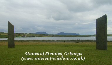
Very little is left
now of the
Stennes circle, but the remaining few stones offer a tantalising
glimpse at the way the monument would have looked when all 12 stones were
originally present. The size and straight edges of the stones gives this circle a look and feel
unlike any other in the world.
The Stones still stand over 5m
tall, with the Hills of Hoy in the background. Both the Ring of Brodgar and
Maes Howe are easily visible from Stennes, reminding one that they are only
a small part of a larger, ceremonial arena which connected the megaliths
with the landscape, in a way rarely visible today.
(Map of Orkneys)
There are only four remaining stones
today, but when the site was excavated by Grahame Richie in 1973, he found the sockets
for 12 stones. In the centre of the stone circle there was a square
stone structure, flush with the ground, at the entrance of which Ritchie
found the remains of a pair of standing stones. Radiocarbon dating of the
ditch produced a date of 3,040 BC. The deep-cut ditch which surrounds the
stones was cut 2 metres down into rock requiring the removal of
18,000 cubic metres of rock. (16).
On Christmas Day 1814, the tenant farmer
of the day, Captain W. MacKay, tried to
destroy the Stones, angry that visitors to the site were damaging his
fields. MacKay had broken up one stone, locally known as Odin Stone,
and felled another before he was stopped. His actions roused the anger of
the locals and there were two attempts to set fire to his property. The Odin
stone was a holed-stone, through which, any
promises sealed with clasped hands through this hole were said to be
unbreakable (1)
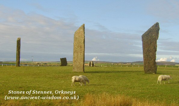
Thousands
of man-hours must have been devoted to hewing the 2m (6 ft 6 in) deep and 7
m (23 ft) wide ditch from 1250 tons of solid sandstone bedrock. but the ditch and outer bank are now almost
disappeared; the three stones of the cove were reconstructed on 1906.
Actually, the cove has been 'restored' using some fallen stones to form what
was then mistakenly thought to have been their original formation.
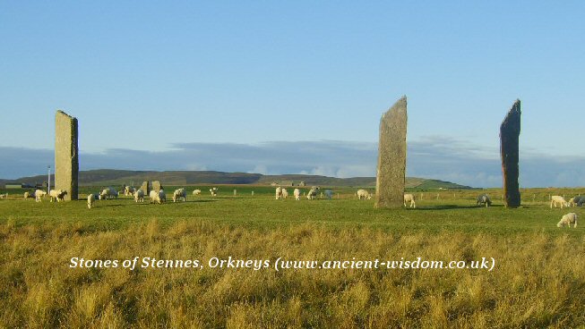
The Stennes circle originally had a diameter of
31.7m (104 ft) and a total of 12 stones; the tallest is about 5 m (16 ft) high, but not far away at
the mouth of the causeway, is an even taller stone of 5.6m
(18.5 ft) high and known as the
'Watch-Stone'.
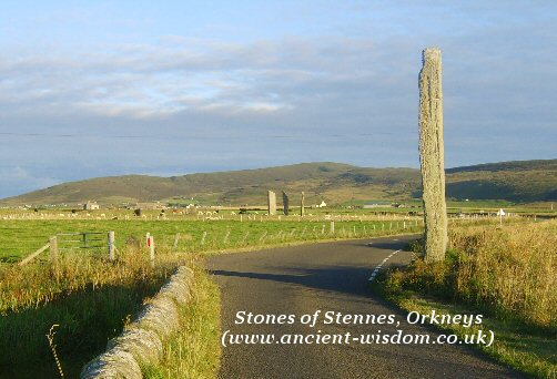
Stennes Stones from the Causeway with remaining Watchstone in foreground.
|
The Orkneys Complex
Current archaeology is revealing
the presence of a large complex along this causeway (The
Ness of Brodgar),
uniting, at the same time as separating the Stones of Stenness
and the
nearby Ring of Brodgar.
The landscape has been compared to the prehistoric landscape around
Stonehenge, acting as a symbolic and physical gateway between
the living world and the land of the dead.
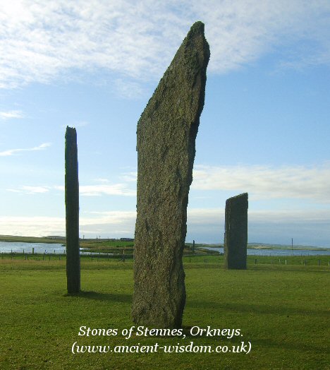
View from Stennes across the Causeway.
(Note: Both the
Watchstone and
Brodgar can be seen in this photo)
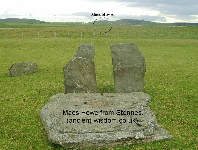
While in this photo,
Maes-Howe Passage mound appears directly between the two stones of the
restored Cove (Was this an original alignment?)
(More about the Orkneys
Complex)
|
Tradition: According to Dr. Robert Henry, an 18th century antiquary, the site was
once known as the Temple of the Moon, and the
Ring of Brodgar
as the Temple of the Sun. There are stories of couples going first to the
Temple of the Moon, where the woman fell down on her knees and prayed for
strength, and then going to the Temple of the Sun where the man did the
same. Each New Year's Day, the local people met at Stennes church and
danced and feasted for several days.
(Stone
Circles Homepage) (Archaeoastronomy)
(Orkneys Homepage)
(Other
Prehistoric Scottish Sites) |