|
Location:
5km from Evora, (N114), Alentejo, Portugal. |
Grid Reference:
38�
33′ 28″ N, 08�
3′ 41″ W |
 Cromeleque Dos Almendres:
(Twin-Stone Circle and Menhir).
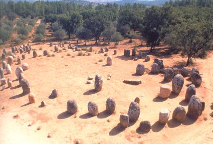 Set in the beautiful and sacred Alentejo landscape, this
double stone circle is now considered one of the oldest in
Europe.
The orientation and association with other
nearby megaliths (i.e. Zambujeiro), combined with the
astronomical significance of the location itself demonstrate the
importance of astronomy to the builders.
A part of the Evora complex in Portugal. This
region is becoming known as 'The Iberian 'Mesopotamia'.
(Map of
the area-how to get there)
|
Cromeleque dos Almendres:
|
('Alto das Pedras Talhos', 'Almendres stone circle').
The site consists of two stone circles, the product of
sequential building phases. The result is an oval of 92 stones, which
measures 30m x 60m. and includes various markings such as cup
marks,
spirals and circles which can still just be seen on some of the stones
(there are apparently ten inscribed stones - but only 4-5 are now visible).
(Plan of the
circle)
The Almendres Cromlech
is believed to be one mankind�s
first public monuments. It's the largest existing group of structured
menhirs in the Iberian Peninsula, and one of the largest in Europe. This
megalithic monument consisted originally of more than an hundred
monoliths, some of which over the ages were taken away for other uses. A
recent digging showed that there were several building phases during the
Neolithic period (5,000 - 4,000 BC.).
The 'circle' has been constructed on the top of a hill from
large, almost anthropomorphic quartzite
stone. Access is free and excellent, with overnight stays possible in the car-park
(Please leave the
site as you find it). The site is located a
within a short walk of the contemporary Menhir dos
Almendres.
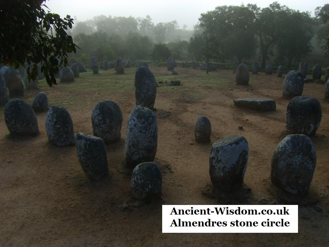
The 92-stone Circle
is actually two circles.. That were built oriented
to different equinoxial directions.
(The 92 menhirs are considered by some to
mark the number of days in a quarter year)
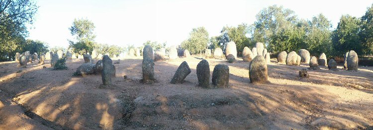
Most of the stones have 'flattened'
faces, all of which seemingly face towards the sun.
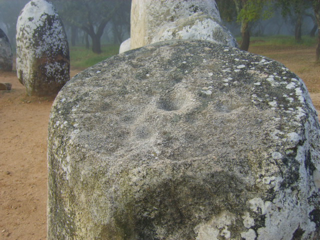
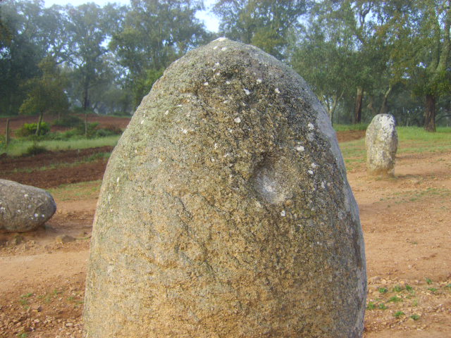
The cup-marked stone (No.8) at the top of the circle (above left), has
its face at almost 90� from the orientation of the circle, facing ENE. Another cup-marked stone from lower down (above right), faces roughly the
same direction.
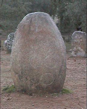
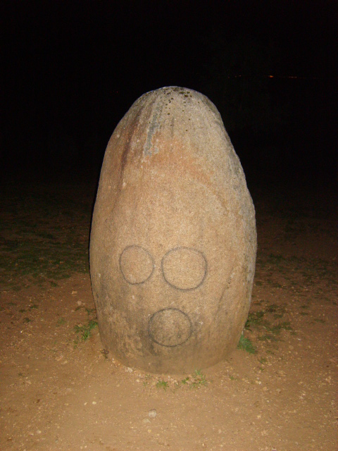
The photo on the left was taken in 2006, while the one on the
right was taken in 2007. (The circles were kindly 'coloured-in' for us that
year...hmmm).
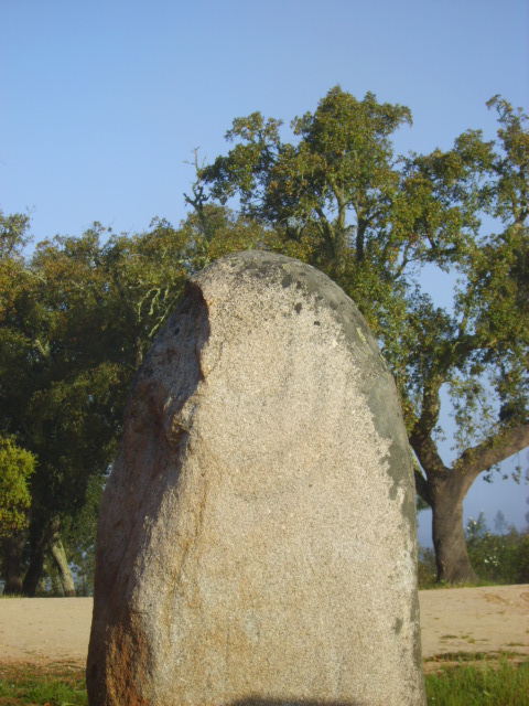
The stone on the right has
what appears to be a part of a spiral - or possibly three concentric circles
on the top.
In the following photo, the stone in front
(with markings on its upper flattened-face), was casting a shadow which fell across
both the stone (right), and another stone simultaneously (see below).
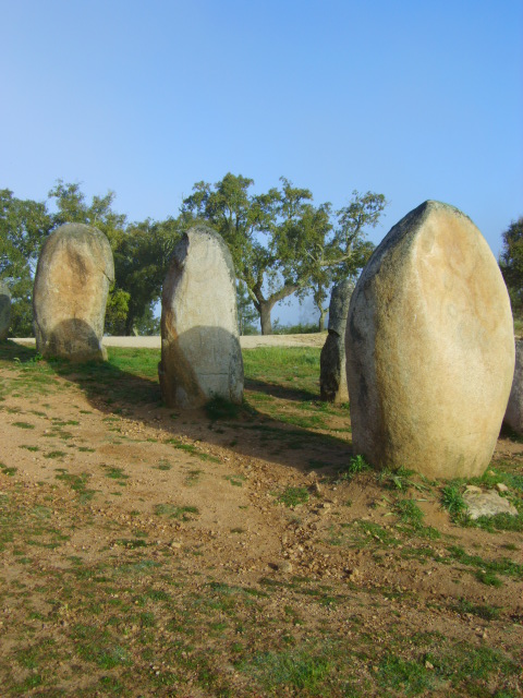
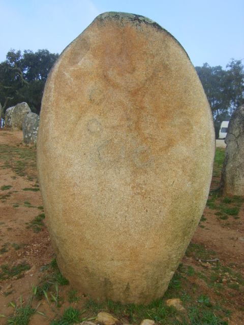
Although they are hard to distinguish,
the face of the stone casting the shadow has several interesting features on
it, better seen in the photo on the right.
|
Chronology.
The site has been dated from
'various phases throughout the Neolithic period (4th to 5th millennium), by
when it had acquired the look it has today' (Ref: Notice-board at
site).
This is the oldest known stone-circle in Europe.
|
Archaeo-astronomy:
The latitude of the site may
explain both the presence of such a grand stone circle, and of the high
concentration of megaliths on the vicinity. (Now referred to as: The
Iberian Mesopotamia).
It is a curious fact that the two
latitudes over which the Moon passes on its maximum settings over
it's 18.6 year cycle, are the same latitudes at which both
Stonehenge and Almendres were located.
(38˚
33' N - Almendres) and (51� 10' N
- Stonehenge).
The declination of the Moon over
its 18.6 year cycle ranges between these two latitudes in terms of
the moon being on the zenith of the viewer (passing directly
overhead). This means that at both Stonehenge and Almendres, the
moon at its maximum declinations would pass overhead.
The Almendres Circles are also the
terminal point for an alignment which runs across Portugal for over
50km, connecting at least three of the most significant sites in the
country together. If one stands at Almendres on the spring full
moon, it will rise on the horizon at approximately 110�
and travel directly towards you, passing first over the (now
relocated) Xarez 'quadrangle', then
over the largest passage mound in Iberia (Zambujeiro),
which is orientated along the same azimuth with its opening facing
the rising moon.
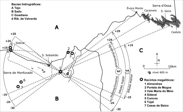
On the map above, the same azimuth appears to continue past Almendres
to 'Sideral'.
This very important
fact is one of the strongest pieces of evidence that the Neolithic
builders of this monument were aware of the natural rhythms of the sun
and moon. However, there is a secondary lunar association through the
fact that the Almendres circle is one end of a proposed 50km alignment
which follows the azimuth of the spring full-moon (110�).
The alignment continues eastward passing the Zambujeiro
passage-mound, ending at the Cromeleque da
Xarez, near Monsaraz making it the longest confirmed prehistoric
alignment in Iberia.
(More about the Almendres-Xarez alignment)
So while it is clearly possible to
demonstrated a lunar significance at Almendres, it is interesting to note
also that the circle
is orientated towards - and has stones that face both the sunrise
and sunset of the equinoxes, possibly due to the fact that Almendres is
actually two circles. In addition, the Menhir do Almendres (see below) was
erected just over a
kilometre
east, and is in line with the top of the circle at winter solstice so that when viewed from the cromlech, the menhir points to the
sunrise in winter solstice, and vice-versa regarding the sunset (Although
the distance and topography between the two sites make it unlikely that the
two sites were ever inter-visible).
Having mentioned that the Almendres circle is associated with Stonehenge
through both their latitudes sharing a common lunar significance, it is
pertinent that both sites also demonstrate orientations towards significant
events of both the lunar and solar cycles.
(Similarities Between European Megalithic Complexes)
(More about Megaliths and
Archaeo-astronomy)
(The Evora Complex of
Megaliths)
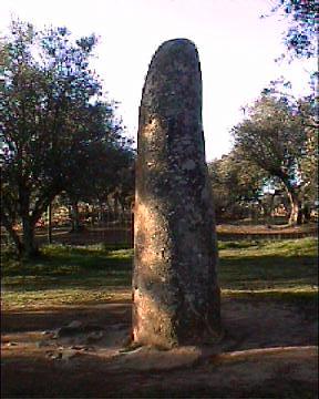
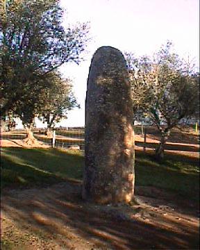
This
Standing stone is approximately 1 km East from its neighbouring Circle the
Cromeleque
Dos Almendres. It is
described as 2.5m high, but actually stands at least 3m. It is reputed to
have fallen twice in living memory; once during a cyclone in 1941 and again
in 1964.
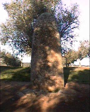
The Solstice line between the
Cromeleque and Menhir at Almendres could have been used as a reasonable
measure to mark the winter-solstice.
(Ref:
Cromeleque dos Almendres: Crookscape.org)
(List of Prehistoric Portuguese sites)
(Portugal Homepage)
(Archaeoastronomy)
(Stone Circles)
|