|
Location:
Modern day Luxor City, Egypt. |
Grid Reference:
25� 43' 0 N, 32� 38' 60
E |
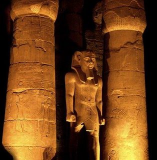
 Karnak:
(Thebes).
Karnak is the largest of the temple complexes at
Thebes (The Egyptian Middle and New Kingdom Capital). It was built over
several several episodes of construction and enlargement from around
2055 B.C to 395 A.D
(3). It was originally surrounded by the famous city
of Thebes and in its heyday was the Vatican of its time. Most of
the remaining structures were built during the 18th Dynasty. The city
was completely sacked in 667 B.C by the Assyrian ruler
Ashurbanipal.
Although the oldest standing building remains are
only from the 12th dynasty, and most of the original temple compound now
lies under the city of Luxor and is therefore currently inaccessible by
archaeologist's, the earliest evidence from archaeology so far
demonstrates activity as far back as 3,200 BC. (4)
(Click
Here for Map with Location)
|
The Karnak Complex: (Ipet-isut- 'Most select
of places') |
This was once the largest sacred centre in all the
ancient world (It covers almost 200 acres 1.5km by 0.8km). The area
of the sacred enclosure of Amon at the heart of Karnak alone is 61
acres and is large enough to accommodate several average cathedrals. It
was said to have been staffed by 80,000 people in the time of Ramasses III.
The
Karnak complex is the work of several
Pharaohs and is dedicated to the supreme deity Amon-Ra. The site consists of
several huge temples, a
forest of columns, pylons, obelisks, and avenues of sphinxes. An ancient obelisk still stands
and is said to weigh approximately 323 tons with a height of 29 metres. The
majority of the complex was
built around 1,500 BC. although
Lockyer
dated it astronomically as having a foundation
date of 3,700 BC.
(1)
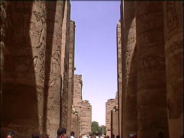
At Karnak as at Heliopolis, a belief existed that
the site was the place of creation, where Amun-Ra made the first mound
of earth rise from Nun.
|
Chronology of Karnak.
Sir Norman Lockyer calculated a date of 3,700 BC. based on the alignment of
the temple of Amen-Ra in relation to the summer solstice sun-set. The orientation
was determined from change in amplitude.
For
those interested, here is a quote from Lockyer:
'Taking the
orientation as 26�,
and taking hills and refraction into consideration, we find that the true
horizon sunset amplitude would be 27� 30'.This amplitude gives us for
Thebes, a declination of 24� 18'. This
was the obliquity of the eclipse in the year 3,700 B.C., and is therefore
the date of the foundation of the shrine to Amen-Ra at Karnak..'
(1).
Lockyer's
date is disputed by Egyptologists as it is unclear which part of the
setting sun was used as the 'setting marker' (i.e. edges, top, centre,
first glimpse, last glimpse etc), an argument often used against Lockyer,
who was accused of using different 'setting markers' at different sites.
Recent excavations have pushed the history of Karnak
back to around 3200 BC (4), when there was a small settlement on the bank
of the Nile where Karnak now stands.
Two brick-built mastaba tombs dating from the 3rd
or 4th dynasty have been found in the Theban area, and a small
group of tombs have been found dating from the 5th and 6th
Dynasties in the area of the necropolis known as el-Khokha. In addition,
no buildings survive in Thebes older than the portions of the Karnak
temple complex, which date from the Middle Kingdom, although the lower
part of a statue of King Niuserre of the 5th Dynasty has been
found in Karnak.(2)
|
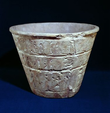
This superb example of
an Egyptian 'Water-Clock' was found at Karnak in 1904, and dates from the
reign of King Amenhotep III (1415-1380 BC). It is made of alabaster and
was used for indicating the passage of time. In use, the vessel was filled
with water, which leaked out slowly from a small hole near the bottom; the
time being indicated by the level of the water remaining within.
(5)
|
The Main Structures at Karnak: |
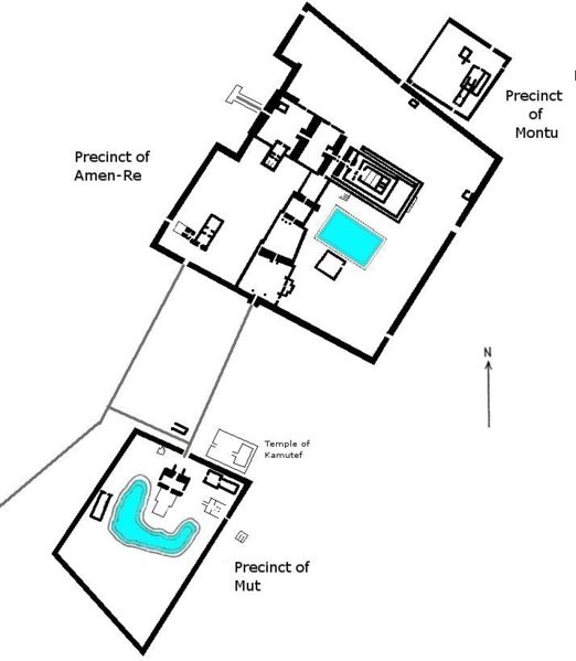
The Karnak Temple Complex.
|
The Great Temple of Amon-Ra.
The oldest remains of the temple
date to the reign of Senwosret I of the 12th Dynasty
(2), and
therefore represents some of the oldest remains at Karnak. Much of the
site was covered in sand until it was excavated.
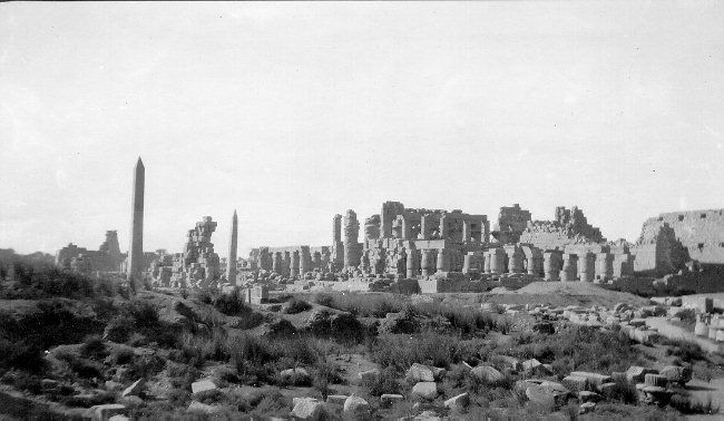
Nineteenth century photograph of Karnak.
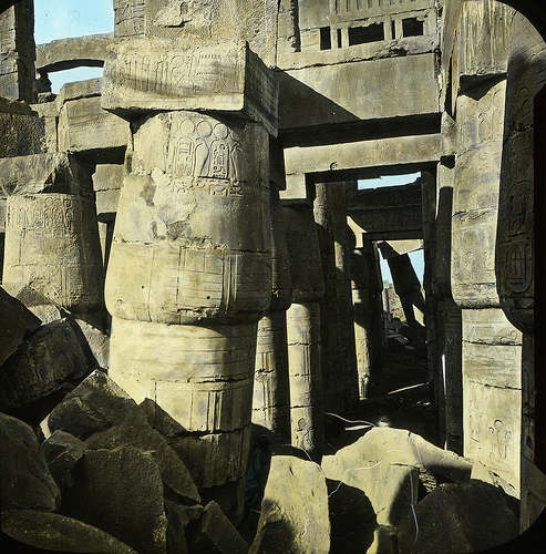
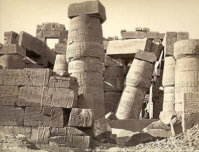
The condition of the temple at Karnak before
restoration.
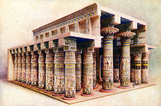
Impression of the original, finished temple.
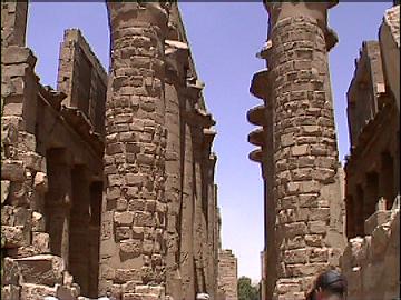
The huge central pillars of the
hypostyle.
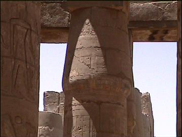
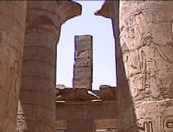
There are two
styles of pillar at Karnak...'Papyrus' and 'Lotus'.
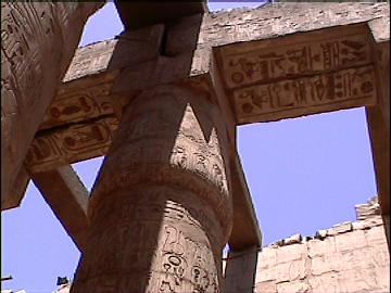
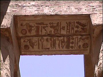
All of which were
covered with hieroglyphs.
The Temple of Amon Ra has at its
sacred heart, the 'holiest of holies', which was orientated towards the
summer solstice sunset.
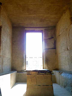
The Inner Sanctum: The Holiest of Holy's. The Heart of the Amun-Ra
Complex.
|
|
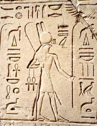
The Temple of Montu:
Montu was the major god at Karnak before Amun.
'Just north of the Temple of Amun-Ra, are the foundations of an earlier, but also central and primary,
temple dedicated to the god Montu. Little remains of this temple, not
because it was weathered by the elements, but rather because it was
systematically deconstructed and its building stones used in the
construction of other temples. According to Schwaller de Lubicz, this
mysterious dismantling of temples, found at Karnak and numerous other
places in Egypt, has to do with the changing of the astrological cycles.
The supplanting of the bull of Montu with the ram of Amon coincides with
the astronomical shift from the age of Taurus, the bull, to the age of
Aries, the ram; the earlier temple of Montu had lost its significance
with the astronomical change and thus a new temple was constructed
to be used in alignment with the current configuration of the
stars'.(4)
Montu was the original god in the Theban
area. (Montu, originated in the form of a local solar god in Upper
(southern) Egypt, apparently at Hermonthis (City of the Sun). His
worship appears to have been exported to Thebes around the time of the
11th Dynasty.
|
|
The Enclosure of Mut:
The southern part of Karnak contains
the temple of Mut, on the east bank of the Nile, more than 900 feet
south of the temple of Amun-Ra.
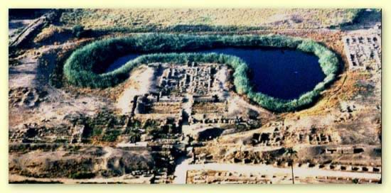
The main Mut temple is surrounded on three sides by a
sacred lake called the Isheru, which is a term used to describe sacred
lakes specific to precincts of goddesses who can be leonine in form. The
Mut Precinct's Isheru is probably fed by an underground spring. |
Alignments at karnak -
Sir Norman Lockyer
was very particular about the orientation of the temple of Amen-Ra, which
dominates Karnak, and was found to align with the summer solstice sunrise.
He said of it:
Evaluation of the site of the temple of Amun-Re at
Karnak, taking into account the change over time of the obliquity of the
ecliptic, has shown that the Great Temple was aligned on the rising of the
midwinter sun. (6)
The earliest axis included the famous
Great Hypostyle Hall built by Ramses II on an east to west alignment. Sir
Norman Lockyer (1836-1920) proposed a midsummer sunset alignment of the
Main Axis of the Great Temple of Amon-Re (see The Dawn of Astronomy,
1894). As Lockyer noted of Karnak, it was 'a scientific instrument of very
high precision, as by it the length of the year could be determined with
the greatest possible accuracy.' By some accounts, the temple at Luxor may
have no less than four well-defined alignment changes involving stars.
Unlike solar alignments which can generally last for thousands of years
intact, stellar alignments are much more critical because of the
precession of the equinoxes, and last only a few hundred years. Lockyer's
measurements showed several Karnak temples had been altered over the
centuries to match the precessional changes in their aligned stars.
(3)
(More about
precession)
|
The Karnak Sphinx's.
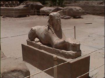
Rows of sphinx's
line the entrance to the temple of Amon-Ra, both inside and out. They are
mostly Ram-headed.
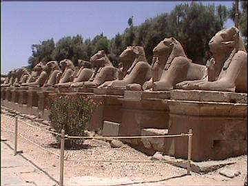
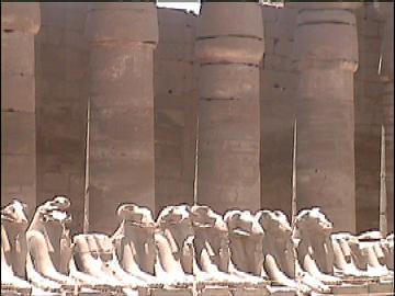
An avenue bordered by sphinxes
originally linked the Karnak complex with the Luxor temple.
(More about
Sphinx's)
|
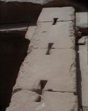
Construction Techniques at Karnak.
The blocks of the temple were joined with 'metal-ties'
similar to those found at
Giza, Dashur,
Denderra (And
Tiahuananco,
In South America).
The soft metal is believed
to have functioned as a structural stabiliser, preventing movement between the
stones. While it is easily understood how such techniques are seen in
other sacred temples in Egypt, the discovery of the exact same technique
(along with several other specific construction techniques), in the pre-columbian
sacred centres of South America, lends weight to the suggestion of contact
between the old world and the new world.
(Other
Examples of Prehistoric Construction Techniques)
|
The Karnak Obelisks.
There are two obelisks still standing at Karnak.
The obelisk erected by Queen Hatshepsut (1473-1458BC). is 97 feet
tall and weighs approximately 320 tons. An inscription at its base
indicates that the work of cutting the monolith out of the quarry
required seven months of labor. Nearby stands a smaller obelisk
erected by Tuthmosis I (1504-1492 BC). It is 75 feet high, has
sides 6 feet wide at its base, and weighs between 143 and 160
tons.
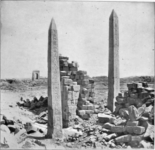
Hatshepsut raised four obelisks at Karnak, only
one of which still stands.
Tuthmosis I
was the first to erect obelisks in Karnak. It was 22 metres high,
of red granite and had its pinnacle encased in electrum or gold.
Tuthmosis celebrated five sed festivals, and on each occasion,
obelisks were set up to commemorate the event: the first three
pairs were erected in Karnak, the fourth in Heliopolis (now
located in London, New york) and his fifth is now in Rome � the
so-called �Lateran� obelisk.
(More about Egyptian obelisks) |
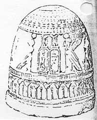
Thebes: The Original Earth Navel.
Herodotus mentioned that the temple of Amon-Ra was an Egyptian 'Earth Navel' from which doves were sent by
the priests to other sacred sites such as
Delphi
and
Dodona, both
oracle
centres with some curious ancient connections to Egypt. This subject was
extensively researched by Livvio Stecchini, Peter Tompkins and Robert
Temple, all of which have published research on the subject, the conclusions
of which suggest that ancient Egypt was operating a system of temple
placement according to longitude and latitude.
(More
about Earth Navels)
|
The significance of the latitude of Karnak - (25� 43' 00")
(This latitude, whether through accident
or design, has an important geometric significance).
It is has been noticed that certain
significant ancient Egyptian temples were located on geometrically significant
latitudes. In the case of Karnak (Thebes), we can see that the latitude
is a result of the following simple mathematic procedure:
(90 �
/ 7 which equals 12.857�)
Although this number may seem to have no immediate significance, there has
been much work on the theory that the ancient Egyptians were aware of the
dimensions of the globe, a theory which finds favour in the specific
placement of particularly significant sacred sited.
Livvio Stecchini was the first to suggest
that the ancient oracle centres were placed at
specific latitudes which he called the 'Oracle octave'. He suggested that
the historical narratives of Herodotus, who made a reference to the
connection between the oracle centres of Ammon-Ra and Delphi. (which is
situated at 38.57 �
N).
If the Northern half of the hemisphere of earth (90�),
is divided by seven,
then one can start to look at the ancient sacred sites in a different light.
The 'First Cataract' of Egypt falls exactly on first division on latitude
12.857� N, the Temple of Amon (Thebes), falls on
the second division:
12.857�
x 2 = 25.714� N (25�
43' 00" N)
The Third is home to
Delphi
(and the Evora complex in Portugal).. both on
latitude 38.57� N, and the fourth, the home to the largest pyramid in
Europe, Silbury Hill at (51.428� N).
|
(More about Egyptian Geodesy)
(Oracle Centres)
(Other Egyptian Sites)
|


