|
Location:
Gozo Island. |
Grid Reference:
36� 1' 16.3" N, 14� 15' 15.3" E.. |

 Ta' Cenc:
(Dolmen).
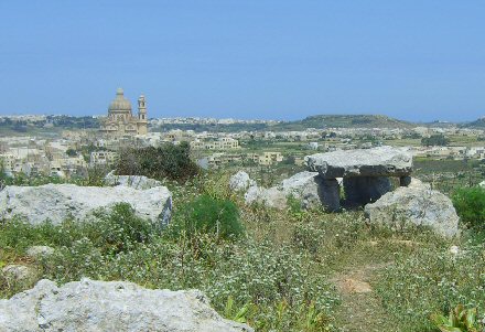
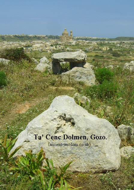
This small,
unimposing dolmen is located on the South coast
of Gozo Island.
Ta' Cenc is the
junction point of two alignments on Gozo. It overlooks the
Xewkiga Church (The third largest dome in Christiandom and
itself built over a dolmen), behind which lies the
Ggantija/
Xarghra complex. The three form an
alignment across the island of Gozo. It also forms an alignment
to the Qala Menhir through the Tal-Qighan cluster of megaliths.
On the northern lip of Ta� Cenc, looking
across towards Xewkija, three tombs assumed to be of the Early
Bronze Age Tarxien Cemetery phase can be found, if carefully
sought. The first consists of two rows of upright slabs, perhaps
once the walls of a gallery grave. Close to them is a more
typical dolmen, with a capstone supported on other blocks. The
third is similar, built into a more recent field wall 600m to
the east. There may once have been a fourth well off to the
south east, but this can no longer be found.
(1)

The Ta' Cenc - Ggantija/Xaghra alignment: (15 �-193�)
This alignment runs from Ta' Cenc through the
Xewkija Church and onto the Ggantija/Xaghra complex. Although the
present church at Xewkija is new, it is built on the same site as
previous churches in the centre of the village, which is claimed in
the local guide book by Mgr. Dr. Anthony Gauci, Gozo - A
Historical and Tourist Guide to the Island (1969), to be the
first to be inhabited in Gozo. The book also reveals that up until
the seventeenth century a large dolmen was visible on the site of
the present church. It had a 15 foot square capstone and four
uprights about five and a half feet high, and was used as part of
the church's foundations, along with a 25 foot menhir and assorted
other stones. The Ggantija/Xaghra complex conforms to the
circle/mound theme found at many important megalithic sites across
Europe.
(More about
the Circle/Mound theme at prehistoric European Complexes)
The Ta' Cenc - Qala Menhir alignment (70 �
-250�)
The local name of the 'Qala Menhir is "Il-Hagra
l-Wieqfa". It is a pock marked stone, rectangular in plan, about
five and half feet on its longest sides and 13 feet tall, forming a
'needle' shape if viewed from a distance which, unfortunately is no
longer possible as it is hemmed in on all sides by modern houses.
Between Ta' Cenc and the Qala Menhir is the Tal-Qighan (Borg Il-Gharib)
site which is on the floor of the valley plain east of Xewkija on
the road to Qala. There are two groups of megaliths on either side
of the road. They are in a poor state of preservation, compared to
Ggantija at least, but are so close together that they may have
formed part of the same structure, perhaps a 'temple' or major
observation centre. They are apparently unexcavated and little is
known about them. One group of stones forms a rough circle whilst
the other is a horseshoe with the open end looking towards the 13ft
high QalaMenhir.
(Dolmens Homepage)
(Leylines)
(Other Maltese sites)
|
|