|
Location:
Yorkshire Wolds, England.
O/S TA 098677. |
Grid Reference:
54.093�
N,
0.321�W. |

 Rudstone:
(The 'Red-Stone' Monument').
The largest Standing-Stone in
Britain in what is often claimed to be the oldest village.
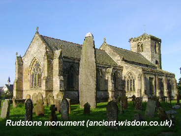
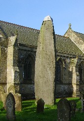
The Rudstone monument is the largest standing stone in Britain. It
stands 7.8m high and estimated to weigh 26 tons. It was fashioned from
grit-stone from Cayton bay, around 16 km distant. Excavations
(By Sir. William Strickland) in the late 18th century suggested
the monument extends as deep below the ground as it stands and although this seems
unlikely, the statement remains to be verified.
The largest standing stone in Britain, stood beside 'All Saint�s' Church,
in what is said to be the
oldest village in Britain.
 The parish register contains a description of the monolith written by one of the parish clerks. After a rough pen-and-ink
sketch of the monolith appears the following:-
There are no authorities to be depended upon in regard to either
the time, manner, or occasion of its erection. It is almost quite
grown over with moss from top to bottom.
In the year 1773 its top being observed to decay through the rains
descent upon it, Mrs. Bosville ordered a small cap of lead to be put
on it in order to preserve it, which was accordingly done.
Its dimensions within ground are as large as those without, as appears
from an experiment made by ye late Sr. Wm. Strickland, of Boynton.
The names of the immediately surrounding
hills
(Ba'al Hill, The Rudstone Beacon and Beacon Hill), suggest that the region
had an important role in prehistoric affairs.
The name Rudstone derives from the old
English words meaning 'cross-stone'
(4), offering the possibility that
Anglo-Saxons may have once placed a cross on top in an attempt to
convert it. Similar conversions were performed on several Breton
megaliths, such as the standing stone at Duzec.
There is a smaller stone on the
north-east side of the churchyard, also made of gritstone, and close
beside it a cist constructed of sandstone slabs. These too seem to be
prehistoric structures. (4)
|
The Rudstone Cursus:
Cursus monuments are one of the most
functionally enigmatic of prehistoric structures. Surrounding
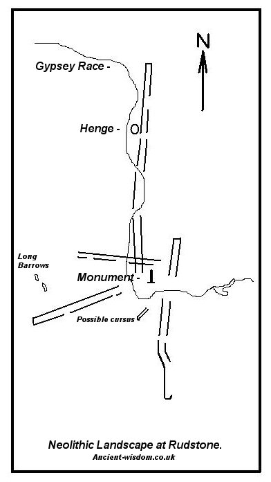
Rudston, East Yorkshire, a cluster of at least four cursus
converges on a bend in the Great Wold Valley. Of these monuments,
Cursus A, or the 'Woldgate Cursus', is particularly unusual, with
a curving 'dog-leg' plan. The unique shape
of this structure provides an opportunity for studying cursus
morphology with the aim of interpreting its function -
essentially, why does the structure curve in this way?

Barclay and Bayliss have assessed the
Radio-carbon evidence for the five cursus and assigned their
construction to the second half of the fourth millennium BC.
(2)
The Rudston group contains an
unparalleled concentration of cursus monuments. Cursus A is the
southern most of the group. The southern end of the cursus
survives as an earthwork and the remainder is visible on air
photographs as two parallel ditches. The cursus is 2700 metres
long by circa 58 metres, it tapers to 41 metres at the south
terminal.
Cursus A is the only one of the
group where both ends are visible, both of the terminals are
square in plan.
It is
noticeable that the Gypsey Race was used to define a part of an edge of the Cursus for
a while.
(More about Cursus) |
Alignments:
An alignment between Rudstone beacon and
beacon hill as defined by one of the cursus
(6).
|
The Neolithic Ritual
Landscape.
The Neolithic modification of the landscape
appears to have started with the construction of the two long
Barrows on the horizon just over 2km directly west of the spur
where the Rudstone monument now stands. (1)
The Great
stone was erected upon a natural spur, overlooking a striking
change in course of the Great Wolds Valley and the Gypsey Race,
which form a natural amphitheatre with the spur as its focus.
The Gypsey Race is the only permanent free-flowing water supply
in the Yorkshire Wolds. The Gypsey Race used to flow far faster
in the past and has a tradition associating it with having
prophetic abilities.
(5)
Cope
(6), says that the site was 'once a great
Neolithic centre which stretched for miles'. He adds writes that
the Brigantes or 'People of the Brig' worshipped their Great
Goddess from before Neolithic times.
The monument
connects the Rudstone Beacon and Beacon Hill through the alignment
of a Cursus. There are several 'Howes' nearby, when combined with
the several prominent 'hump's or Tumulus, the Henge and the
dramatic landscape form together to become a significant, but
almost lost landscape.
(Other examples of Altered Landscapes) |
Archaeo-astronomy:
One of the Cursus is orientated roughly north-south, and
another roughly east-west.
Gallery of Images: Rudstone Monument

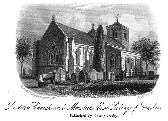
Rudstone as it was 1873.
|


