|
Location:
Oxfordshire, England.
(O/S -
SU 300868). |
Grid Reference:
51� 34' 46" N,
1� 33' 56" W. |
 Dragon Hill:
(Beacon Hill).
Said to be the place where St. George slew the dragon.
The Uffington Horse,
Uffington 'Castle'
and Dragon Hill are all located beside the ancient track called the 'Ridgeway'.
Dragon Hill itself is an artificially levelled chalk outcrop below and
immediately in front of the Uffington White Horse. Tradition claims the
bare chalk patch on the top of the hill to have been caused by the blood spilled
when St. George slew the
dragon. Wayland's Smithy lies a couple of miles along the
Ridgeway.
(Click here for Map of
site)
|
Dragon Hill: (Uffington White horse). |
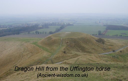
The levelled hill sits below and in front of the
Uffington Horse.
The flattened top is similar to
that seen at Silbury Hill, which
also sits on the Ridgeway.
It is generally
accepted that the top of the hill was artificially shaped, although no
reason has been put forward to explain why. One assumes that the
flattened top played an important part in the ceremonial use of the
landscape. Other flattened hill-tops in England were often used as
'Beacon' hills, where fires were lit.
The Whole valley has been likened to the shape of
a Dragon's head facing North, with the flattened top of Dragon Hill
itself, represents the eye of the Dragon. This theory leads to the
suggestion that along with the artificial flattening of Dragon Hill, the
western gulley's may have also been partially carved in order to
accentuate the image of a Dragon. However, having looked at overhead images
of the location, I have to confess that such a connection is tenuous
at best. Make your own mind up...
Dragon Hill sits on the Uffington Ley, which runs
almost true north.
(More about Ley-lines)
|
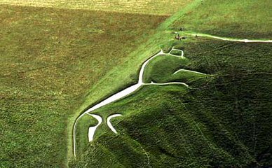
The Uffington White Horse.
Considered to be Britain's Oldest Chalk hill
figure. It is considered by some to represent a dragon itself.
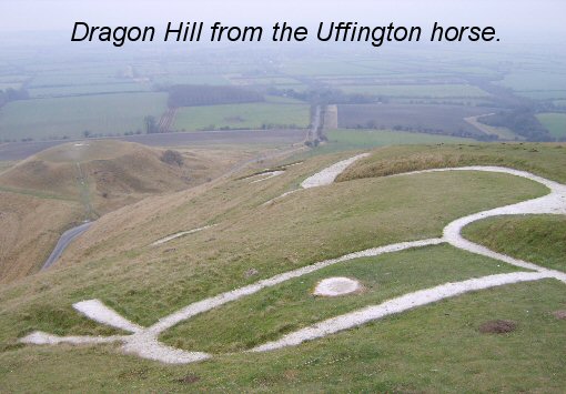
'Until 1995 the Uffington white horse was thought
to date from the Iron Age. However, in the nineteen-nineties, a new
dating technique was developed. This technique, optical stimulated
luminescence dating (OSL), can show how long soil has been hidden
from sunlight. The lines of the horse consist of trenches dug in the
hillside, then filled with chalk. OSL testing of soil from between
the lower layers of that chalk shows that it has been buried
since between 1400 BC and 600 BC, and probably between 1200 BC
and 800 BC, and thus the horse is of Bronze Age origin'.
(1)
Coins have been found in Britain dating to around 1000 BC
which show the same image.
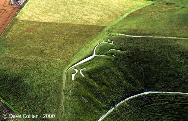
The Uffington Horse from Overhead. (The only way
it can be seen complete)
Because the horse was carved on the crest of the
hill, it is not possible to see the whole of the figure at any
one time from the ground. At the same time, parts of the horse are visible from up to
20 miles distant. Legend says that the horse leaves its location
once a year to graze in the 'Manger' below. |
Uffington 'castle' which
sits on the
top of the hill is an impressive iron age hill-fort.
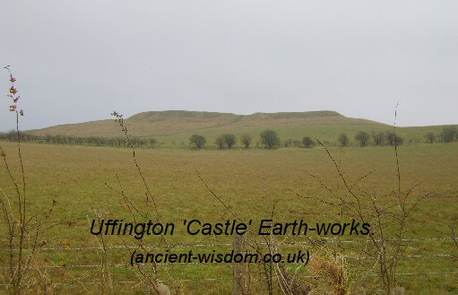
A
simple design of single rampart and ditch at 857ft (262m), Uffington
Caste forms the
highest point in Oxfordshire. The original west entrance remains, whilst
smaller entrances through the south and north-east ramparts were created
by the Romano-British during their occupation of the site.
Waylands Smithy only
a couple of miles further along the Ridgeway adds to the importance of
this site.
(Other Prehistoric English sites)
|