|
Location:
Cranborne Chase, Dorset,
England. |
Grid Reference:
50� 57' N. 1� 58' W. |

 Dorset Cursus:
(Cursus).
The largest cursus in Britain.
Now viewed as being two cursus end-to-end. The combined length of
10km, and an estimated 0.5 million man-hours labour make this one of the
most significant prehistoric remains in Britain.
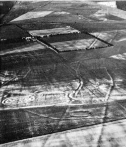
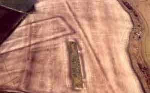
Today, much of this great earthwork is flattened and can
only be see through crop-markings or soil markings which in the right
conditions, allow one to see the outline of the cursus stretching across the
Dorset landscape.
As with several other cursus, Dorset
cursus appears to have a complimentary henge nearby, in the shape of
Knowlton Henge, which is only a short
distance to the east.
(Click here for Map of
site)
|
The Dorset Cursus:
(Gussage Cursus' - 'Pentridge Cursus') |
With an estimated half million man hours in construction,
this earth-work counts as one of Britain's largest megalithic constructions.
Unfortunately today, there is left to see to the untrained eye.
The Dorset cursus once consisted of a pair of
parallel banks (1.5 m tall) running about 82 m apart, with external ditches
1.5 m deep and 2 m wide. One bank is regular, whilst the other meanders, a
feature found at several other cursus in Britain.
Chronology
Believed to have been constructed in two different phases at around 3,300
BC, this cursus must have been of great importance to the Neolithic
community that gave birth to it.
Carbon Dating
Results: Dorset Cursus.
OxA-624     DC 84/A,bone, Bos primigenius                    4570�120
OxA-625     DC 84/B,bone, Bos                                4440�100
OxA-626     DC 84/C,bone, Bos                                4770�120
OxA-627     DC 84/D,bone, Bos                                6800�100
OxA-628     DC 84/E,bone, Bos ?                              6460�140
Ref: (Archaeometry 28(1) (1986), 116-125)
The Southern section
of the cursus is considered older than the northern section.
It has been suggested that the Dorset
cursus was designed to be experienced from North-east to south-west, towards
the great 'Death island' formed by the Hambledon Hill causewayed enclosure, a
few kilometres away (Tilley, 1994).
What is surprising about the Dorset Cursus is that its overall design
makes little sense except to someone inside it. From a distance, despite
its great length, it would not have been very visible - indeed, some
sections may have been dug through wooded areas. The same is true of the
curses at Stonehenge and
Rudston. The concept of a cursus seems to
exclude outsiders. This is also indicated by the lack of recognisable
entrances through the ditches and banks.
However, to those who did stand within it, the Dorset Cursus makes
its most impressive visual impact between the Bottlebush terminal and
the long barrow on Gussage Cow Down, if only because this includes the
longest stretch which can be seen from one vantage point. And this
alignment is the midwinter sunset sight line. In fact, there seem to be
five astronomical sight lines between the cursus and particular mounds,
or between mounds. Again, other cursus seem to have been built in
similar ways. The Dorchester on Thames cursus aligns on the midsummer
sunset, while Aubrey Burl has suggested that the Stonehenge cursus could
have marked the equinoctal sunrises.

Cursus often run across valleys, and
their setting and scale can only be fully appreciated by standing at the
terminals which are usually intervisible. It has frequently been pointed
out that many cursus have their terminals close to water courses or run
across an interfluve between two rivers. This is especially true of many
valley-situated cursus, and it may also be noted that because of their
proximity to rivers some cursus are wholly or partly covered by
alluvium. The Dorset cursus is no exception to this, crossing a river
and three valleys.
Astronomy
The Cursus' only significant astronomical
alignment is related to its south-westerly orientation: an observer at
the Gussage Cursus terminal on Bottlebush Down would see the midwinter
sun set behind the long barrow lying across the Cursus on the ridge of
Gussage Down. Bradley (in Barrett et al. 1991) emphasise the way in
which this phenomena could only have been witnessed from within the
cursus itself.
 The long-barrow itself has been suggested to
have been built before the cursus. A connection between the cursus and
long-barrows (other cursus). There are sever other long-barrows on
Cranborne Chase, and many of these are still found along the route of
the Cursus. This association between the Cursus and the alignment of
these barrows suggests a common significance. The long-barrow itself has been suggested to
have been built before the cursus. A connection between the cursus and
long-barrows (other cursus). There are sever other long-barrows on
Cranborne Chase, and many of these are still found along the route of
the Cursus. This association between the Cursus and the alignment of
these barrows suggests a common significance.
The
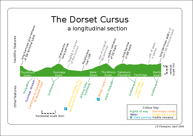
cursus incorporates at least two long barrows. On Gussage Hill, ST 91 SE 9 lies
across the interior of the cursus, while the Pentridge Cursus has SU 01
NW 47 actually incorporated into the bank of the northwestern side,
although the barrow's alignment differs slightly.
'The line of
the Cursus may either have been established between a series of existing
long barrows, or some of the barrows themselves may have been aligned on
prominent features of the Cursus. Where both earthworks share the same
axis no sequence can be established, but where one appears to be aligned
directly on the other, either the relationship is fortuitous or an
obvious sequence is involved. The Cursus appears to have been aligned on
three earlier barrows, although a number of barrows appear to have been
created after the Cursus and share its alignment. Indeed, no less than
half the long barrows within a kilometre of the Cursus closely imitate
features of the Cursus.'
Ref: (John C.
Barrett, Richard Bradley and Martin Green. Landscape monuments and
society. (Cambridge UP 1991))
(More
about Cursus)
(Other Prehistoric English sites)
|