|
Location:
Wallonia, Belgium. |
Grid Reference:
50� 20' N, 5� 31' E. |
 W�ris:
(The Belgian Capital of Megaliths).
The area
surrounding the village of
W�ris has been found to contain a high concentration of megalithic monuments.
It likely had a
particular significance to the prehistoric inhabitants and builders
of the monuments, many of which are composed of stones weighing
several tons each.
The area is host to
a 5km long alignment, which is also the longest in Belgium. The main
Dolmen in the area; the 'Northern Dolmen' sits at the junction of
this alignment and another equinoxial alignment (E-W), from the
nearby natural rock formation called the 'Pierre Haina' or 'Stone
of the Ancients'. The natural inclination of the stone towards
the east, its prominent high position and the traditions still
associated with it today, suggest that this stone held an importance
as far back as the Neolithic and may be the very reason for the
building of so many monuments in the area.
The 'Stone of the
Ancients', (Pierre Haina).
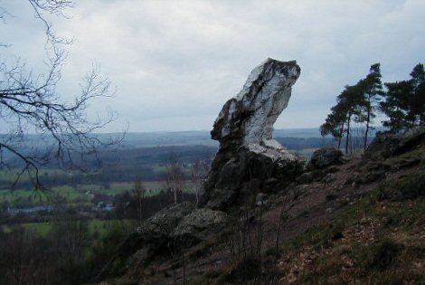
This vaguely
anthropomorphic natural rock outcrop stands out on the horizon
like a beacon. It faces east and is painted white each year on
the equinoxes following an ancient tradition by the locals.
(Photos Credits:
http://tw.strahlen.org)
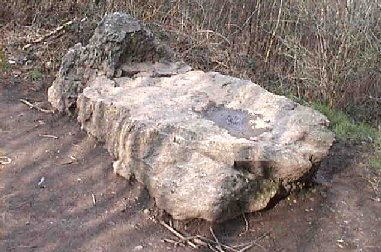
The 'Lit du Diable' or the Devil's Table.
There are
several legends associated with these stones. In particular is
that the Pierre Haina is a seal or 'plug' to the underworld, from
which on certain nights, the devil would come out and fly around,
eventually resting on the nearby stone called the 'Devils Bed',
(Above, apparently partially carved). Tradition has it
that he would sleep there until the first Rooster crowed in the
morning, when he would return to the underworld, replacing the
Stone of the Ancients as he went.
The W�ris Alignment:
Unique in Belgian
archaeology, this alignment offers several megalithic sites over a 5
Km distance.
(More about Leylines)
When the menhirs
and two dolmens are plotted on a topographic map, the monuments
appear to form an alignment which, adding the site of a missing
menhir, extends to 5,000 yards. However, running NNE-SW, this
orientation fails to mark any rising or setting positions of
either sun or moon, nor does it point to any significant horizon
features. (1)
but it does follow the natural contours of the landscape.
|
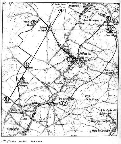 |
1). Weris. 2). Dolmen de Weris. (Northern)
3). Bois de Vesin.
4). Danthine Menhir (s).
5). Southern Dolmen and Menhirs.
6).Three Menhirs, Oppagne.
7). Quarry.
8). Dolmen de Pierre Haina.
9). The Devils Bed. |
The NNE-SW, this orientation fails to mark any
significant astronomical orientation. However, the alignment
does follow the natural contours of the landscape, being surrounded
by the hills of the Fagne-Famenne valley region, which is marked
by an abrupt depressions in the
schist landscape.
The Tour Menhir:
(Menhir de Heyd) To the north of the valley at the hamlet Tour,
was resurrected in 1998. First cited by Helen Danthine in
1947, this stone is said to lie close to the site of a spring. The Tour Menhir is the most remote and
Northerly stone in the alignment and is 2.8 Km from any natural
source of Pudding-stone.
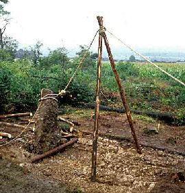
The Menhir de Heyd during
Restoration 1998.
(Photo Credits:
http://www.megalithe.be/monuments/weris/heyd)
The Northern Dolmen:
(Allee Couverte Norde) Near the village W�ris
is the Northern Dolmen, an impressive "gallery" type tomb, 33 feet
long, and dated to the first half of the third millennium.
(3)
It has a now-ruined anti-chamber and spirit hole, and is
covered by a massive, broken capstone, estimated to weigh 30 tons
and
supported by stones of which two are rectangular blocks weigh some
18 and 20 tons each. From the ante-chamber extends the remains of a straight stone
avenue with thirty stones on either side, shown on an etching by the artist Moreels, drawn in
1888, when the dolmen was first excavated, cracking the capstone in
the process. During a subsequent excavation in 1906, the
ante-chamber was incorrectly restored: it was floored with broken
stones, which originally formed the capstone of the chamber. The
orientation of the monument is a couple of degrees of the larger
alignment. This dolmen sits at the junction of the main alignment
and the equinoxial alignment from the 'Stone of the ancients', due
east.
A nearby re-sited tall menhir is actually
one of two menhirs excavated nearby in recent years.
(1)
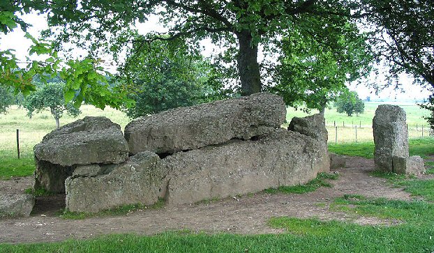
The Northern Dolmen has a
'spirit hole' in its entrance and a 30 stone alignment
(Photo Credits:
Jean-Pol GRANDMONT)
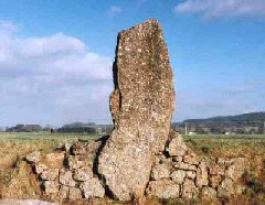
The Danthine Menhir:
One of three stones from the 'Long-stone' field. The largest was
discovered in 1947 by Prof Helen Danthine, who moved it 130m to have
ot placed beside the road, and from which it earned its name 'The Danthine Menhir'.
Measuring 12 feet tall, the top of the slab sloping at a 45 degree
angle, it weighs about eight tons. Two other stones were recovered
from the field in 1983, 50m from the Danthine Menhir which have now
been reinstated in their original position behind the Weris Dolmen.
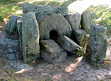
The Southern Dolmen:
In the vicinity is the Southern Dolmen, a "sunken gallery type"
tomb, approximately 23 feet long, it also features an incorrectly
restored ante-chamber with 'spirit hole', which originally facilitated
offerings to the ancestral spirits. The main axis of the chamber is
55�, indicating a mid-summer solstice orientation, when the solar
rays illuminate the circular spirit hole. At this dolmen, which may
originally have been similar to a chambered mound, amateurs dug up
five more stones in recent years.
The Three Menhirs of
Bouhaimont at Oppagne: Continuing towards the southwest, there is a setting of three menhirs at right angles to
the "alignment", of which the tallest stone measures 8 ft tall.
First reported in 1888 by L. Moreels, at
one time, they were removed by the owner of a hotel at Hotton, who set
them up
in his garden. In 1906, he was persuaded to return the three
megaliths close to their original
setting at Oppagne. Sadly, during transport, one of the menhirs
broke in two halves, following which these were cemented back
together. All stones of this "triad" have pointed tops. They are
made of pudding-stone, like the dolmens. The original location pits
for the stones are said to be just 5m south of their current
position.
(4)
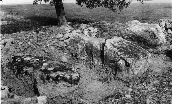
Photo from 1906 showing
the stones both reclining with one already broken. (Now restored)
The Quarry: To the south of W�ris village, with its
11th century church dedicated to St. Walburge, there is located on
the flank of a hill what is presumed to be the prehistoric quarry
for the pudding stones. Below the rock face is what has been
interpreted as a "ramp" to facilitate the removal and transportation of the stones by the megalithic
builders. This implies that for the construction of the Northern
dolmen, the 30 ton capstone was hauled to its site for some two
miles.
(1)
The Holed Stones
(Portals):
Both the larger
dolmens in the area (Northern and Southern) have small holes in
their entrances. These 'spirit holes' or 'portals' are a common
feature in Dolmens particularly in Northern Europe and Russia
(Caucasia) where they are seen more frequently than not. The
term spirit holes suggests that they were incorporated into the
monuments to allow the spirit free access, however several
examples of stone 'plugs' have been found which suggest that
they would have been only opened at particular times.
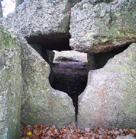
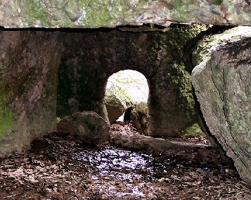
Northern Dolmen
(Left), and Southern Dolmen (Right).
(More about Holed Stones)
(More
about Dolmens)
(More
About Menhirs)
(Prehistoric
French Sites)
(A-Z
Index)
|


