|
 Prehistoric Japan: (Zha'pan,
Nippon)
 'The
Land of the Rising Sun'. 'The
Land of the Rising Sun'.
The Japanese
Palaeolithic age covers a period starting from around 100,000 to
30,000 BC, when the earliest stone tool implements have been found,
and ending around 12,000 BC, at the end of the last ice age,
corresponding with the beginning of the Mesolithic Jōmon period. A
start date of around 35,000 BC is most generally accepted.
The Japanese archipelago was disconnected from the continent after
the last ice age, around 11,000 BC.
The
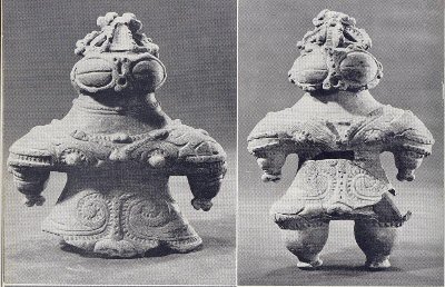
Jomon period lasted from about 14,000 BC to 500 BC and
represents the beginning of 'civilisation' in Japan, marked by its
distinct pottery, weaving and domestication of plants and animals.
(Above: Jomon 'Dogu')
Article: ColumbusDespatch.com (May,
2013)
'The
largest ever genetic study of native South Americans identified a
sub-population in Ecuador with an unexpected link to eastern Asia.
The study, published in PLOS Genetics,
concluded that Asian genes had been introduced into South America
sometime after 6,000 years ago � the same time the Jomon culture was
flourishing in Japan.
Back in
the 1960s, the renowned Smithsonian archaeologist Betty Meggers
argued that similarities between the pottery of the contemporaneous
Valdivia culture in Ecuador and Japan�s Jomon culture indicated that
Japanese fishermen had �discovered� America about 5,000 years ago.'.
(Link
to Full Article)
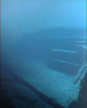
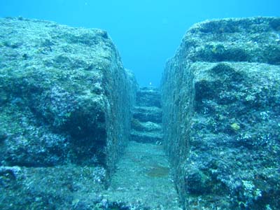
Found near the south shore of Okinawa, Japan in
1995, these fantastic underwater structures were at first argued to have been
fashioned by nature.
'The sunken buildings are known to
cover the ocean bottom (although not continuously) from the small island of
Yonaguni in the southwest to Okinawa and its neighbouring islands, Kerama
and Aguni, some 311 miles. If, after all, ongoing exploration here does
indeed reveal more structures linking Yonaguni with Okinawa, the individual
sites may be separate components of a huge city lying at the bottom of the
Pacific. The single largest structure so far discovered lies near the
eastern shore of Yonaguni at 100 feet down. It is approximately 240 feet
long, 90 feet across and 45 feet high'. (2)
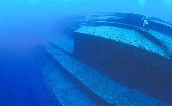
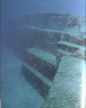
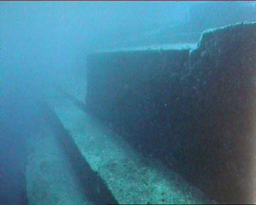
'The 'Yonagumi monument
is over 50m long in an east-west direction and over 30m wide in a
north-south direction. The top of the structure lies about 5m below sea
level, whereas the base is approximately 25m below the surface'
(3)
Genetic studies have revealed that
native Taiwanese populations carry the purest form of Asian
specific Human Lymphocyte Antigens (A24-Cw8-B48, A24-Cw9-B61
and A24-Cw10-B60). Studies have shown that the Taiwan area
was the centre of dispersal for the; Tibetans, Thais, Tlingit,
Kwakuitl, Haida, Hawaiian, Maori, Pima, Maya, Yakut, Inuit,
Buryat, Man, Japanese from Shizuoka and Orochon from North East
China (6).
This major dispersal event, which happened about 6,000 years
ago, suggests a major catastrophic event, such as flooding
of the coastline, which caused an exodus of people, from
which many new civilizations were born. Mysterious megalithic
monuments on Taiwan and numerous underwater ruins north of
Taiwan such as near Yonaguni confirm that a significantly
organized society once existed in this area as much as 10,000
years ago and was destroyed by rapidly rising sea levels.
On Yonaguni Island and elsewhere in the Okinawa area there appears to be an
ancient tradition of modifying, enhancing, and improving on nature (Shinto).
On Yonaguni there are very old tombs (age unknown, but possibly on the order
of thousands of years old) that stylistically appear to be comparable to the
"architecture" of the Yonaguni Monument.
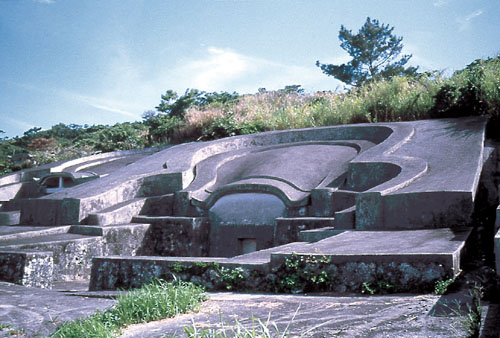
The formations have been
compared to the Okinawa Tomb, a rock-hewn structure of uncertain age.
How old is Yonaguni.?
'The rock-faces appear to be
dressed stone. If this is an artificial, man-made structure then it is
reasonable to assume that it was carved not underwater but at a time when
this area was above sea level. Indeed, this area has experienced major rises
in sea levels during and since the Pleistocene ("Ice Age") and based on
well-established standard curves of sea level rises in the region, as
recently as 8,000 to 10,000 years ago the Yonagumi Monument may have been
above local sea level. Thus we can suggest with some confidence that if
the Yonaguni Monument is a man-made construction then it must be at least
8,000 years old.
(3),(7)
Astronomy:
10,000 years ago Yonaguni was located
very close to the Tropic of Cancer. Today the Tropic of Cancer is
located at approximately 23 degrees 27 minutes north latitude while
Yonaguni Island is located a full degree further north. However, the
position of the Tropic of Cancer varies over the millennia, from under
22 degrees to over 24 degrees, according to a 41,000 year cycle. At
around 8,000 B.C. the Yonaguni Monument was located much closer to the
Tropic of Cancer.
What proof is there that
the site was altered by mankind.?
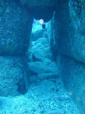 The The
archway (left), has been found composed of blocks 'beautifully fitted
together' and reminiscent of the masonry of the Inca cities.(2)
The structures are said
to resemble ancient buildings on Okinawa itself where sacred buildings
are found near Noro, where burial vaults designed in the same
rectilinear style are still venerated as repositories for the islanders'
ancestral dead.
(2)
Several pieces of
'Stone-tools' were recovered at the site. 'Typical ones are adzes' says
Prof. Masaaki Kimura, 'They are not polished. Their age is estimated as
up to 10,000 years old'. (3)
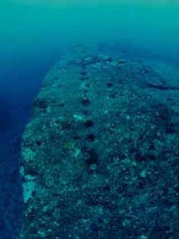
Other evidence presented by those who favour an artificial origin include the
two round holes (about 2 feet wide) on the edge of the Triangle Pool
feature, and a straight row of smaller holes which have been interpreted as an
abandoned attempt to split off a section of the rock by means of wedges (see
right), a feature common in prehistory.
(Other
examples of prehistoric 'quarry marks')
Supporters of an artificial origin also argue
that, while many of the features seen at Yonaguni are also seen in natural
sandstone formations throughout the world, the concentration of so many peculiar
formations in such a small area is highly unlikely. They also point out the
relative absence of loose blocks on the flat areas of the formation, which would
be expected if they were formed solely by natural erosion and fracturing.
If any part of the Monument was
deliberately constructed or modified, it must have happened during or following
the last Ice Age, when the sea level was much lower than it is today (e.g. 25m
lower around 10,000 years BCE). During the Ice Age, the East China Sea was a
narrow bay opening to the ocean at today's Tokara Gap. The Sea of Japan was an
inland sea and there was no Yellow Sea; people and animals could walk into the
Ryukyu peninsula from the continent. Therefore, Yonaguni was the southern end of
a land bridge that connected it to Taiwan, Ryūkyū, Japan and Asia. This fact is
underscored by a rock pillar in a now-submerged cave that has been interpreted
as a fused stalactite-stalagmite pair, which could only form above water.
Quote:
Robert
Schoch 1999
'We should also consider the
possibility that the Yonaguni Monument is fundamentally a natural structure that
was utilized, enhanced, and modified by humans in ancient times. The Yonaguni
Monument may even have been a quarry from which blocks were cut, utilizing
natural bedding, joint, and fracture planes of the rock, and thence removed for
the purpose of constructing other structures which are long since gone'.
(7)
(Other Underwater
Constructions)
(Prehistoric
Pacific Islanders)
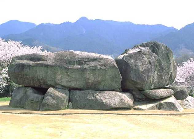
Ishibutai: The largest
Megalithic Tomb on Japan.
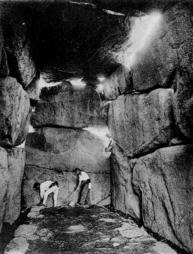 Ishibutai is near
Nara City, in a neighbouring village named "Asukamura" (mura means
village). The chamber is
rectangular measuring 25 ft by 11 ft by 15 ft high (the largest in
Japan), it is approached by a passage 38 ft in length and roofed by
two capstones each weighing between 60 and 70 tons. (Modern
estimates place the largest stone at approximately 75 tons)
(1) Ishibutai is near
Nara City, in a neighbouring village named "Asukamura" (mura means
village). The chamber is
rectangular measuring 25 ft by 11 ft by 15 ft high (the largest in
Japan), it is approached by a passage 38 ft in length and roofed by
two capstones each weighing between 60 and 70 tons. (Modern
estimates place the largest stone at approximately 75 tons)
(1)
(The Top-50 Megaliths of
all time)
The monument
originally consisted of 30 stones.
It is suggested to be the tomb of 'Soga no Umako' from around 626
AD.
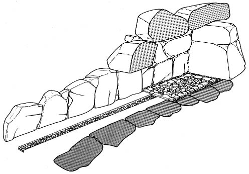
Interior layout
of Ishibutai Tomb.
"Ishibutai"
means "stage made of stone". The village people of old time in
the Asuka area believed this was used as the stage on which a
sacred dance was performed (dedicated) to the Gods.
(More about Dolmens)
Other Interesting
structures in the Asuka region:
The
mountainous Nara prefecture of Japan is home to the
following structures. Perhaps coincidence, but they bear
a striking similarity to the masonry at Machu Pichu as
the following images testify:
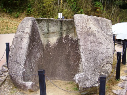
Rhomboid shaped cavity.
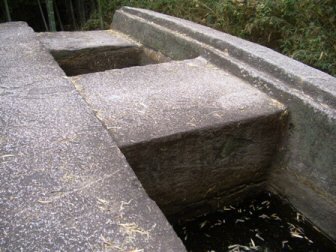
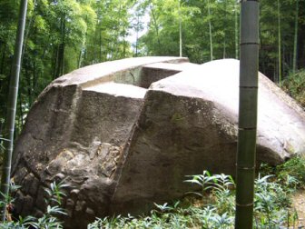
'Hitching Stone?' near the top of Iwafune Mountain.
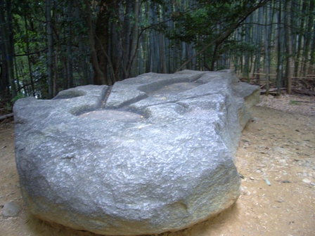
The
channels in the rock above are similar to those found at
Sacsayhuaman.
Photo
Credits and More Information:
http://www42.tok2.com/home/slicer190190/5-37.html
(More about
Machu Pichu)
The Oyu Stone Circle
is located in the 'Akita' Prefecture. Often described as
'Japan's Stonehenge', the Oyu Stone Circle is a prehistoric site
comprising two large circles and a number of other stone structures
and ruins. Thought to be 4,000 years old, the site dates from the
Jomon Period. To construct the two circles, rocks were carried from
the Akuya River, some five to seven kilometres east of the site.

Ceremonial stone circles first appeared at the beginning of Jomon
era. Hundreds of stone circles and stone features have cropped up
all over Japan. Elaborate stone circles were found at several sites
in the Chubu region from the Middle Jomon era and archaeologists
have discovered extremely large numbers in Hokkaido and northern
Tohoku from the Late and Final Jomon era
(More
about Stone Circles)
(With thanks to KASAHARA Kunio for his valuable
input.)
(Prehistoric China)
(Prehistoric Korea)
(Prehistoric Pacific
Islanders)
|