This
concentration of megaliths consists of a stone circle (The King's Men), a standing
stone (The
King Stone), 73m/239ft
NE) and a burial chamber (The Whispering Knights, 357m/0.2mi ESE).
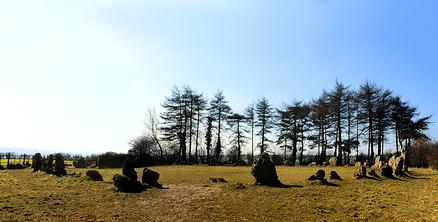
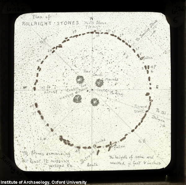
There are about 77 lumps of weathered limestone forming a 31.4m (103ft)
near-perfect circle, some small enough to be almost lost in the short turf.
In 18th century, the antiquarian William Stukeley described this
circle as The greatest Antiquity we have yet seen... corroded like
worm-eaten wood by the harsh Jaws of Time. Early in the 17th century
only 26 stones were standing; in 1882 there was a major re-erection of the
remaining stones.
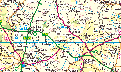
There is no other stone ring near the Rollright Stones, but the circle
lies in an area of henges. Its name has nothing to do with any
supernatural rotation of the stones, but it may derive from Hrolla-landriht as early spellings like Rollindricht suggest,
the
land belonging to Hrolla.
The "King's Men" is a
stone circle that dates from about 2500-2000 BC. It is almost perfectly
round and has a diameter of 104 ft (33 m). Originally, there may have
been as many as 105 stones, but today there are 77 stones. Over a third
of the stones were put back in place during the site's restoration in
1882.
Aubrey Burl called the
Rollright's �seventy-seven stones, stumps and lumps of leprous
limestone�. This number has altered considerably over the years -
drawings from the tail-end of the 19th century, just before the Stones
were scheduled under the 1882 Ancient Monuments Protection Act along
with Stonehenge and Avebury, show about 25 stones in the Circle (see
above). �In
the year 1882 the proprietor of Little Rollright replaced all the
fallen stones in their original foundation.�
The stones are of
heavily-weathered local oolotic limestone: antiquarian William
Stuckeley described them as being "corroded like worm-eaten wood, by
the harsh Jaws of Time" that make for a "very noble, rustic, sight,
and strike an odd terror upon the spectators, and admiration at the
design of 'em".
.jpg) The
Whispering Knights
are accessed by a well-maintained grassy path that leads around the
outskirts of a private field. Here four stones stand upright in a tight
cluster; a fifth, probably the capstone, has fallen. The stones are part
of a portal dolmen-type burial chamber dating from about 4000-3500 BC,
and originally projected out of a low, flat-topped platform that
surrounded them. Dismembered bodies were placed in the chamber for
burial. Human remains were place in the chamber for over a thousand
years, well into the Bronze Age.
The
Whispering Knights
are accessed by a well-maintained grassy path that leads around the
outskirts of a private field. Here four stones stand upright in a tight
cluster; a fifth, probably the capstone, has fallen. The stones are part
of a portal dolmen-type burial chamber dating from about 4000-3500 BC,
and originally projected out of a low, flat-topped platform that
surrounded them. Dismembered bodies were placed in the chamber for
burial. Human remains were place in the chamber for over a thousand
years, well into the Bronze Age.
The King's Stone
(right), is
a large block of limestone about 2.5 m high. This is believed to have
been a marker stone for an early Bronze Age cemetery and was erected
between 1800-1500 BC. Several small cairns containing cremations were
discovered around the stone. The stone's unusual shape is not original;
it derives from early visitors chipping away pieces to take away as
talismans or for healing purposes.